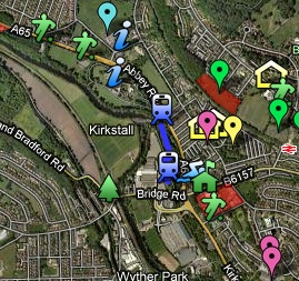
 We now have a map of our local area with local attractions, things to do, sports fields and local issues all shown in one place. Wondered where your nearest playing field was? Its there. Wondered what route the Abbey Light Railway takes? That’s there too.
We’ve also highlighted areas that are an issue for our community and have provided information on projects on the go in the area for you to find out more and get involved.
It will be updated as new things come along and should provide the local community with a visual reference to what is going on in our area.
Launch the Kirkstall Online map
Have a look and let us know what you think, and tell us what else should be on there!
